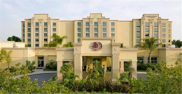
There are 4 ways to get from VA Greater Los Angeles Health Care Center Heliport to Doubletree Hotel Los Angeles/Commerce by train, bus,rideshare, car or plane
Driving
Total time spent: 28 mins
Distance:0.3 mi
Duration:1 min
Head northwest on Dowlen Dr toward Hadley Ln
Distance:495 ft
Duration:1 min
Turn left onto Bonsall Ave
Distance:0.1 mi
Duration:1 min
Turn right to merge onto Wilshire Blvd
Distance:1.6 mi
Duration:2 mins
Take the ramp onto I-405 S
Distance:0.2 mi
Duration:1 min
Take the I-10 W exit toward Interstate 10 E/
Distance:9.6 mi
Duration:11 mins
Keep left at the fork, follow signs for I-10 E/
Distance:3.1 mi
Duration:4 mins
Keep right to stay on I-10 E
Distance:4.4 mi
Duration:5 mins
Take the exit onto I-5 S toward Santa Ana
Distance:0.2 mi
Duration:1 min
Take exit 129 for Eastern Ave toward Atlantic Blvd
Distance:256 ft
Duration:1 min
Turn right onto S Eastern Ave
Distance:285 ft
Duration:1 min
Slight right onto S Atlantic Blvd
Distance:0.6 mi
Duration:2 mins
Turn right at the 1st cross street onto Telegraph Rd
Distance:486 ft
Duration:1 min
Turn left onto Gaspar Ave
Distance:302 ft
Duration:1 min
Turn left
Distance:141 ft
Duration:1 min
Turn left
Distance:128 ft
Duration:1 min
Turn left
Walking
Total time spent: 6 hours 37 mins
Distance:0.3 mi
Duration:5 mins
Head southeast on Dowlen Dr
Distance:446 ft
Duration:2 mins
Turn right toward Sawtelle Blvd
Distance:1.2 mi
Duration:24 mins
Turn right onto Sawtelle Blvd
Distance:0.7 mi
Duration:13 mins
Turn left onto Exposition Blvd
Distance:36 ft
Duration:1 min
Turn left toward Exposition Corridor Bike Path
Distance:0.2 mi
Duration:5 mins
Turn right onto Exposition Corridor Bike Path
Distance:322 ft
Duration:1 min
Slight left onto Exposition Blvd
Distance:184 ft
Duration:1 min
Turn left onto Overland Ave
Distance:0.2 mi
Duration:4 mins
Turn right onto Northvale Rd
Distance:482 ft
Duration:2 mins
Turn left onto Bradbury Rd
Distance:0.9 mi
Duration:20 mins
Turn right onto Manning Ave
Distance:308 ft
Duration:1 min
Slight left to stay on Manning Ave
Distance:1.1 mi
Duration:23 mins
Turn left onto National Blvd
Distance:0.6 mi
Duration:11 mins
Slight left
Distance:0.2 mi
Duration:5 mins
Turn left onto W Jefferson Blvd
Distance:89 ft
Duration:1 min
Turn left onto La Cienega Blvd
Distance:220 ft
Duration:1 min
Turn right toward W Jefferson Blvd
Distance:4.6 mi
Duration:1 hour 33 mins
Turn left onto W Jefferson Blvd
Distance:2.3 mi
Duration:46 mins
Slight right to stay on W Jefferson Blvd
Distance:0.2 mi
Duration:4 mins
Turn right onto S Central Ave
Distance:1.0 mi
Duration:20 mins
Turn left onto E 41st St
Distance:0.7 mi
Duration:15 mins
Continue onto E 38th St
Distance:0.6 mi
Duration:13 mins
Continue onto E 37th St
Distance:2.5 mi
Duration:49 mins
Continue onto Bandini Blvd
Distance:0.6 mi
Duration:13 mins
Turn left onto S Atlantic Blvd
Distance:0.2 mi
Duration:4 mins
Continue straight to stay on S Atlantic Blvd
Distance:0.3 mi
Duration:6 mins
Keep right to stay on S Atlantic Blvd
Distance:469 ft
Duration:2 mins
Turn right onto Stevens Pl
Distance:262 ft
Duration:1 min
Turn left onto S Eastern Ave
Distance:390 ft
Duration:2 mins
Turn right onto S Atlantic Blvd
Distance:0.1 mi
Duration:2 mins
Turn right onto Telegraph Rd
Distance:0.3 mi
Duration:7 mins
Slight left to stay on Telegraph Rd
Distance:279 ft
Duration:1 min
Turn left onto Citadel Dr
Distance:0.1 mi
Duration:2 mins
Turn right
Distance:39 ft
Duration:1 min
Turn right
Distance:26 ft
Duration:1 min
Turn left
Bicycling
Total time spent: 1 hour 54 mins
Distance:0.3 mi
Duration:1 min
Head southeast on Dowlen Dr
Distance:0.1 mi
Duration:1 min
Turn right onto Sawtelle Blvd
Distance:0.2 mi
Duration:2 mins
Turn left onto Ohio Ave
Distance:0.2 mi
Duration:1 min
Turn right onto S Sepulveda Blvd
Distance:0.3 mi
Duration:2 mins
Turn left onto Santa Monica Blvd
Distance:0.3 mi
Duration:1 min
Turn right onto Veteran Ave
Distance:0.2 mi
Duration:1 min
Turn left onto La Grange Ave
Distance:1.5 mi
Duration:7 mins
Turn right onto Westwood Blvd
Distance:0.5 mi
Duration:3 mins
Continue onto National Pl
Distance:0.5 mi
Duration:3 mins
Turn left onto National Blvd
Distance:0.5 mi
Duration:3 mins
Continue onto Exposition Blvd
Distance:0.1 mi
Duration:1 min
Continue onto Durango Ave
Distance:3.6 mi
Duration:21 mins
Turn left onto Venice Blvd.
Distance:3.0 mi
Duration:17 mins
Slight right to stay on Venice Blvd.
Distance:0.2 mi
Duration:1 min
Turn right onto Arapahoe St
Distance:0.1 mi
Duration:1 min
Turn left onto W 18th St
Distance:0.1 mi
Duration:1 min
Turn right onto S Bonnie Brae St
Distance:4.1 mi
Duration:24 mins
Turn left onto W Washington Blvd
Distance:0.2 mi
Duration:2 mins
Turn left after Carl's Jr (on the right)
Distance:0.6 mi
Duration:2 mins
Turn right onto E Pico Blvd
Distance:367 ft
Duration:1 min
Turn right onto S Ezra St
Distance:453 ft
Duration:1 min
Continue onto Union Pacific Ave
Distance:0.2 mi
Duration:1 min
Turn left onto S Lorena St
Distance:0.4 mi
Duration:2 mins
Turn right onto E Pico Blvd
Distance:0.1 mi
Duration:1 min
Turn right onto Esperanza St
Distance:1.5 mi
Duration:7 mins
Turn left onto Union Pacific Ave
Distance:0.2 mi
Duration:1 min
Continue straight onto S Eastern Ave
Distance:1.0 mi
Duration:5 mins
Turn left onto Triggs St
Distance:466 ft
Duration:1 min
Turn right onto S Atlantic Blvd
Distance:0.1 mi
Duration:1 min
Turn left onto Telegraph Rd
Distance:0.1 mi
Duration:1 min
Turn left onto Camfield Ave
Distance:0.2 mi
Duration:1 min
Continue onto Flotilla St
Distance:0.2 mi
Duration:1 min
Continue onto Smithway St
Distance:466 ft
Duration:1 min
Turn right
Distance:128 ft
Duration:1 min
Turn left
Distance:0.1 mi
Duration:1 min
Turn right
Distance:125 ft
Duration:1 min
Turn left
Distance:39 ft
Duration:1 min
Turn right
Distance:26 ft
Duration:1 min
Turn left
Transit
Total time spent: 2 hours 5 mins
Distance:0.4 mi
Duration:8 mins
Walk to Wilshire / Bonsall
Distance:12.5 mi
Duration:54 mins
Bus towards Downtown LA - 6th - Central
Distance:161 ft
Duration:1 min
Walk to 6th / Broadway
Distance:6.2 mi
Duration:26 mins
Bus towards Montebello Metrolink Stn
Distance:1.4 mi
Duration:28 mins
Walk to 5757 Telegraph Rd, Commerce, CA 90040, USA
Questions & Answers
The cheapest way to get from VA Greater Los Angeles Health Care Center Heliport to Doubletree Hotel Los Angeles/Commerce is to walking which costs $0 and takes 6 hours 37 mins.
The fastest way to get from VA Greater Los Angeles Health Care Center Heliport to Doubletree Hotel Los Angeles/Commerce is to driving. Taking this option will takes 28 mins.
No,there is no direct bus departing from VA Greater Los Angeles Health Care Center Heliport to Doubletree Hotel Los Angeles/Commerce,you may have to walk for a while.The journey takes approximately 2 hours 5 mins.
No, there is no direct train departing from VA Greater Los Angeles Health Care Center Heliport to Doubletree Hotel Los Angeles/Commerce. you may have to driving,this way will takes 28 mins.
The road distance between VA Greater Los Angeles Health Care Center Heliport to Doubletree Hotel Los Angeles/Commerce is 20.4 mi.
The best way to get from VA Greater Los Angeles Health Care Center Heliport to Doubletree Hotel Los Angeles/Commerce without a car is to bicycling which takes 1 hour 54 mins.
The driving from VA Greater Los Angeles Health Care Center Heliport to Doubletree Hotel Los Angeles/Commerce takes 28 mins.
VA Greater Los Angeles Health Care Center Heliport to Doubletree Hotel Los Angeles/Commerce bus services, depart from Wilshire / Bonsall station.
You can drive from VA Greater Los Angeles Health Care Center Heliport to Doubletree Hotel Los Angeles/Commerce,which takes 28 mins.
The best way to get from VA Greater Los Angeles Health Care Center Heliport to Doubletree Hotel Los Angeles/Commerce is to driving which takes 28 mins.